
Services
Resource Management
SIL provides a full range of documentation, analysis, management, restoration, and remediation services to protect and improve environmental resources. We recognize the delicate balance between a technologically progressive society and an ecologically sound environment. As rising sea levels and dwindling resources make headlines across the globe, our scientists, geographic information system (GIS) specialists, and engineers are busy restoring damaged ecosystems, and preserving our world, be it a wetland, protected species’ habitat or historic property. We are well versed in applicable state and federal laws and regulations governing documentation of flora and fauna. SIL’s clients have come to rely on our breadth of expertise in managing natural and water resources as well as associated geospatial data.
Our team of engineers, environmental scientists, planners, modelers, GIS analysts and business analysts provides a multi-disciplinary approach to planning, water quality management, and facilities design, and resource/asset management and mapping. In addition to guiding projects through preservation and compliance procedures, this group of environmental scientists and engineers specialize in terrestrial and aquatic assessment, wetland creation and mitigation design, stream restoration, permitting, fish passage design, dam removal, permitting, biological monitoring, and environmental construction. Water resource engineers and planners offers clients expertise in a wide variety of services, including watershed assessments, hydrologic/hydraulic studies, bridge scour assessments and analysis, NPDES, comprehensive stormwater management, erosion and sediment control, flood control, habitat enhancement, and open and closed storm drain design. Our highly skilled team of GIS (geographic information systems) experts, analysts, enterprise system architects, programmers, and technicians is supported by state-of-the-art hardware and software.


our resource management capabilities
01
WATER RESOURCES ENGINEERING AND DESIGN SERVICES
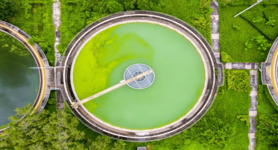
SIL offers a complete range of water resources services that apply a multidisciplined approach to watershed assessments, water quantity/quality management and stormwater facilities design. In addition to investigating, sampling, assessing and monitoring surface water facilities, we conduct planning studies and guide our clients through environmental permitting programs.
Our innovative solutions address challenges ranging from stream restoration, channel relocation and flood control, to stream crossing, bridge replacement, erosion and sediment control, best management practices, open and closed storm drain design, floodplain studies, bridge scour analysis and countermeasure design. Services include:
- FEMA/floodplain studies
- GIS mapping
- Watershed and ecological assessments
- Water quality and aquatic resource analyses
- Wetlands analysis, creation, restoration and enhancement design
- Benthic macroinvertebrate, geomorphic and hydrographic surveys
- TMDL analysis and management
- Hydraulic and hydrologic analysis
- Stormwater management, best management practices (BMPs)
- Erosion and sediment control
- NPDES permitting and regulatory compliance
- Bridge scour analysis
- Closed storm drain design and inspection
- Stormwater management/erosion and sediment control review services
- Fish passage and dam removal studies and design
- Natural channel design and streambank stabilization
- Environmental and post-construction monitoring
- Construction management and inspection
Our team understands that a complete water resources program requires a multidisciplinary approach to planning, water management and facilities design. Every site, whether in an urban or rural setting, poses a unique set of challenges, and as consulting engineers, we recognize the delicate balance between a technologically progressive society and an ecologically sound environment. Our team is experienced in implementing cutting-edge solutions to sustainably manage and treat surface water, including bioretention facilities, floating treatment wetlands, and rain gardens.
To also help clients manage the quality of surface water runoff, SIL investigates, samples, assesses and monitors sites; performs planning studies; and guides clients through environmental permitting programs, such as the National Pollutant Discharge Elimination System (NPDES), Municipal Separate Storm Sewer System (MS4), and Total Maximum Daily Load (TMDL) programs administered by the Environmental Protection Agency.
In addition, engineers develop erosion and sediment control measures to protect surface water during construction activities. When water resources management efforts require design services, SIL offers the professional expertise of civil, structural, environmental, and geotechnical engineers to support planning, design and construction phases as necessary.
02
NATURAL RESOURCES PLANNING, DESIGN AND CONSTRUCTION

SIL provides natural resources planning, engineering, design, and construction services to help protect and restore streams, wetlands, watersheds and forests. Our environmental scientists and engineers apply their expertise in all aspects of wetland science, stream restoration, watershed planning, resource conservation and permit compliance. By integrating sound resource management practices with state-of-the art technology and construction techniques, we offer creative approaches to dam removal, fish passage and other projects for our clients. We provide innovative solutions for restoring urban channels, addressing flashy flows, utilities and property constraints. Services include:
- Natural channel design
- Channel and bank stabilization
- Water quality studies
- Vegetative analyses
- Physical/biological monitoring
- Fisheries studies
- Geomorphological assessment
- NEPA assessment
- Sediment analysis
- Fish passage design
- Dam removal
- Aquatic resource impact analysis
- Ecological restoration/mitigation
- Wetland delineation
- Function/value assessments
- Forest preservation
- Rare, threatened and endangered species
- Permitting
- Alternatives analysis
- Environmental construction services
- Construction inspection and post-construction monitoring
For nearly two decades, SIL has established a leadership role in ecosystem restoration services east of the Mississippi. SIL has undertaken hundreds of miles of stream and river assessments, sediment transport, conceptual and final restoration design, construction management and construction. Final design work has included the preparation of complete construction drawings, specifications and construction cost estimates.
Expanding on our years of experience in natural channel restoration, our team has become a leader in innovative approaches to dam repairs, removal, bypass channels and fish passageways for both structural and natural-like fishways. While many communities enjoy and desire to have water features built or maintained in their communities, the long term inspection and repair expense, human safety and insurance issues along with the growing environmental challenges such as fish passage, dredging and contamination has many questioning what options they have available.
03
GEOGRAPHIC INFORMATION SYSTEMS AND GEOSPATIAL SOLUTIONS

SIL is focused on innovation and the use of applied geospatial technology in developing engineering, scientific, management and decision support solutions. Our expertise and understanding of engineering and business practices enables us to develop innovative solutions for data collection, management, integration and sharing. From an initial needs assessment through implementation and training, we offer services in the fields of geographic information systems (GIS), asset management, database design, and applications development. Our analysts, programmers and information architects are experts in cartography, environmental impacts, National Pollutant Discharge Elimination System (NPDES), parcel and roadway centerline mapping, utilities and watershed projects. Services include:
- Needs assessment
- Gap analysis
- Business process
- System analysis
- Work plan
- Workflow documentation
- Implementation plan
- Quality management plan
- Technical documentation
- User documentation
- Program & project management